
By Meghan Dasilva and Bailee Fenton
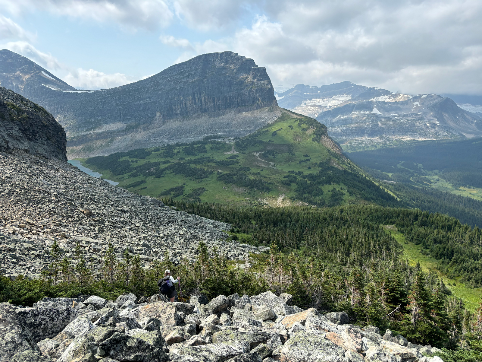
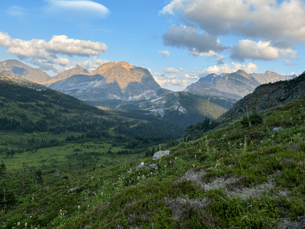
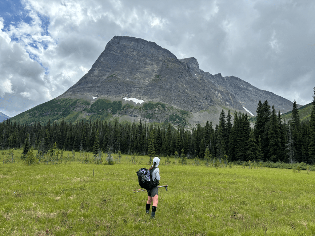
On August 1st, 2020, we were dropped off at Bastille Creek trailhead in Kakwa Provincial Park, and on September 9th, we stood at the monument in Waterton National Park. The Great Divide Trail (GDT) was the most scenic, yet harshest thru-hike we had ever completed. The trail’s remoteness, unpredictable weather, and various terrain navigation tested us in ways we’ve never encountered on a thru-hike. But enduring the GDT meant we had the rare opportunity to eat, breathe, and sleep in the Canadian Rockies; that was all the fuel we needed. The Canadian Rockies, unlike their southern neighbouring Rockies, are primarily composed of sedimentary rock that has been folded and thrust-faulted. These heavily glaciated areas have resulted in rough, uneven peaks and U-shaped valleys, making the elevation gains the highest in the entire Rocky Mountain Range1. Since then we have grown a strong attachment to the GDT, every year returning to hike alternates or wander the trail. A couple of years ago we caught wind of a northern extension, a route proposed to link Kakwa Provincial Park to Monkman Provincial Park. A trailless adventure, few had attempted. In 2023, we read Dan’s trip report2 and the idea turned into a goal.
Over the next year, we researched the route3 and established it would be an objective for 2024. We decided on a 7-day itinerary despite being warned it was ambitious to run the route that quickly. We stuck to our stubbornness, wanting to minimize our pack weight, even though it meant taking on more risk. Looking back, we can both admit, without hesitation, that we made plenty of mistakes. It is one thing to sit at a computer and research a route, and a wildly different experience to be physically and mentally drained attempting to execute it. But on July 31st, on the 7th day, after pushing ourselves through many tribulations we hiked into Monkman Provincial Park.
To give you some context about our outdoor experience, we are both fairly experienced hikers. Before this route, we faced everything from route finding and bushwhacking to undesirable temperatures and continuous 30+ mile days. We’ve hiked the Pacific Crest Trail, Continental Divide Trail, Vancouver Island Trail, and of course, the Great Divide Trail. Meghan has also hiked Te Araroa and Bailee has hiked the Lowest to Highest Route. When not thru-hiking we enjoy endless grueling day hikes and multi-day adventures that make us question why we like hiking. We often joke about becoming “weekend warriors”, but let’s face it our heads turn too easily for a long-distance challenge.
We hesitated to write a trip report about this route. The Great Divide Route (GDR) is a whole other beast and we didn’t want to encourage hikers to blindly follow in our footsteps. The Northern Canadian Rocky wilderness offers an unparalleled sense of isolation and adventure, and the GDR is the most remote and wildest route we’ve ever encountered. After some reflection and time to process, we decided to share our experience to give future GDR hikers a glimpse of our experience. While trying to remain neutral, our experience will be written subjectively, and neither attempt to encourage nor discourage this route.
Day 1: Dead Horse Meadows to Jarvis Lake Cabin
Distance: 29.4 km
Elevation Gain/Loss: +332 m / -367 m
Total Time: ~8 hours
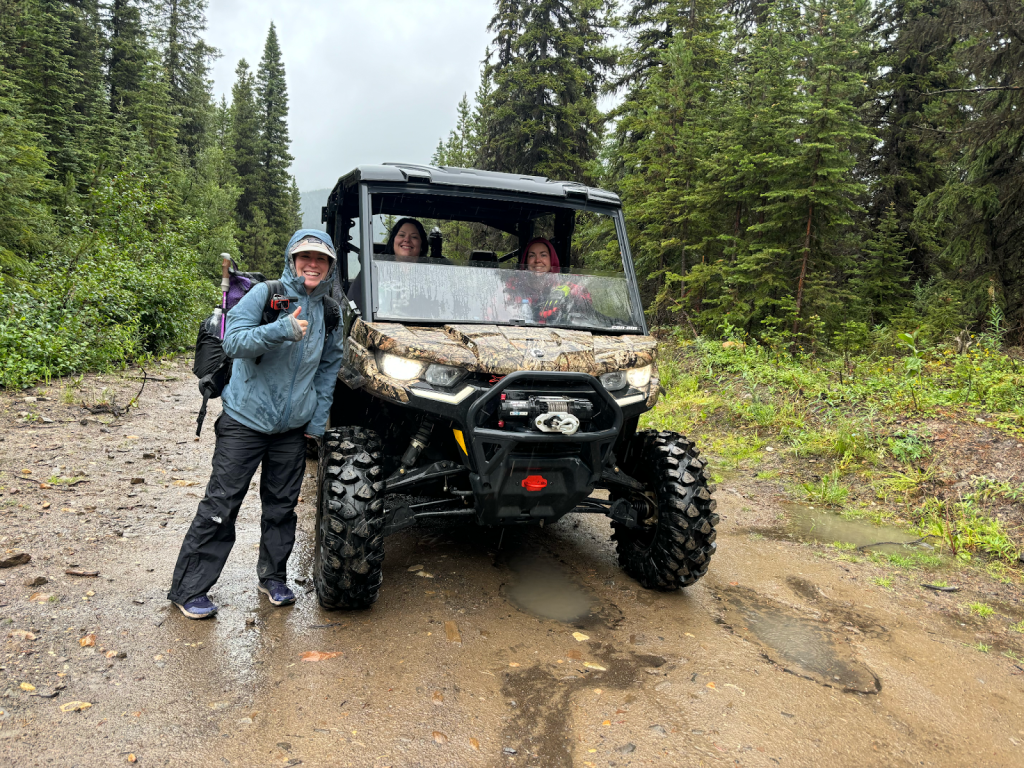
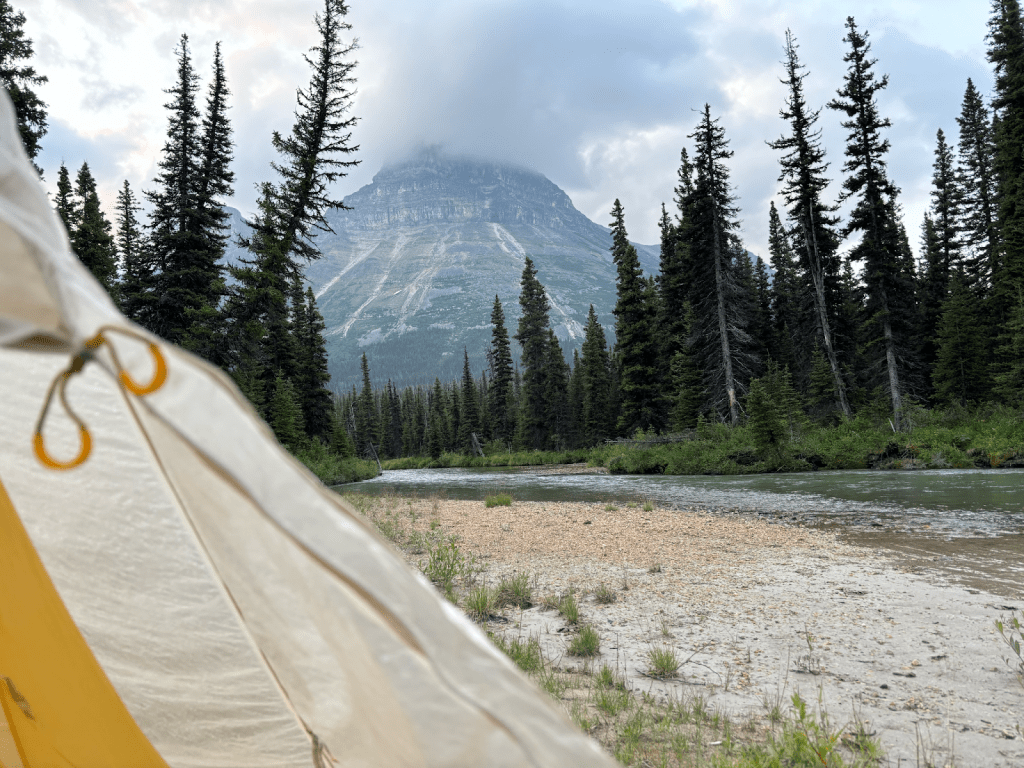
We traveled from Grande Prairie, Alberta via Two Lakes Road where we were dropped off at Lickcreek Staging Area. After a couple of kilometres of hiking we quickly crossed the border into British Columbia and lost an hour, the rest of the route remained in British Columbia. If you are lucky enough to get a ride to or from Deadhorse Meadows by ATV, as we did, you will be cutting out some less impressive miles. We arrived at Deadhorse Meadows, at approximately 1 p.m., soaking wet and uncomfortably cold. The rain had started the night before and there were no signs of it letting up. The only thing we could hope for was to make it to Jarvis cabin that night and be able to dry off and warm up. This was a big objective for a late start, we had around 30km to go from where we were dropped off. We would dream and joke about the cabin for the rest of that day.
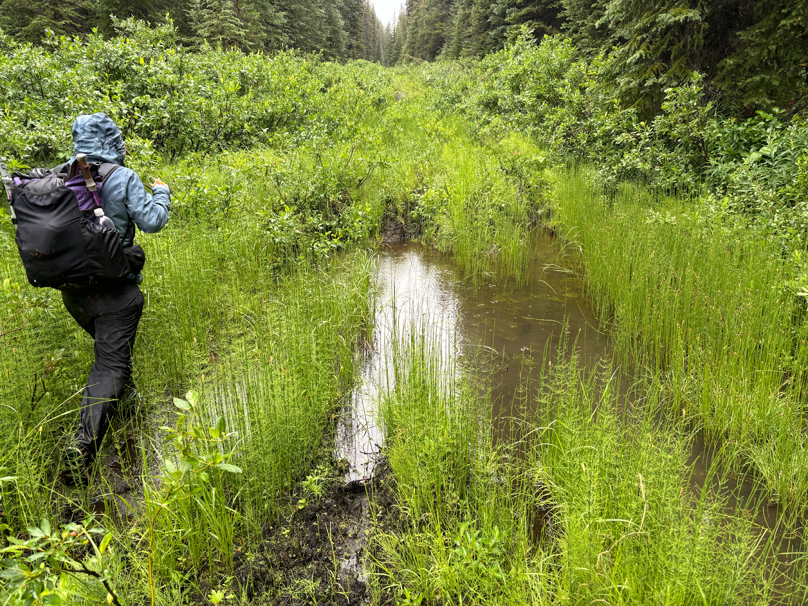
Deadhorse Meadows to the Kakwa/Jarvis junction is a snowmobile trail, it was easy to follow with scattered bogs in the lower portions. Although resulting in wet feet, we hiked through the bogs without the water ever reaching above our knees. The fun began when we hit the Kakwa Lake and Jarvis Lake junction, the Jarvis Lake trail was less inviting. Here a faint trail threads between two ponds and quickly becomes overgrown. There is a hiker sign for a trail that we easily missed and if you are looking at our GPX track, you will see our squiggly line of confusion. However, at the sign, there is a trail somewhere hiding in the bushes. As we hiked on we found the trail easily lost, but easily found again. Minimal navigation was needed, but we did check our maps to be sure to stay on track. Drenched from the vegetation that continued to smack us with more water, we were even more motivated to get to the cabin. We heard it was beautifully maintained and a pleasure to stay at. We moved quickly, with no breaks. We talked about drying out, eating a warm meal, and enjoying the luxuries of the woodstove and cabin. We hit Jarvis Pass and the cabin became more of a reality. Jarvis Lake is a series of small lakes, and the last large lake is where the cabin resides. Here, we found the trail that leads directly to the cabin from both directions. I don’t think either of us had been so excited to see signs of human presence (the cabin), on the first day of a thru-hike, maybe this should have been a sign of what we were up against, if so, we ignored it.
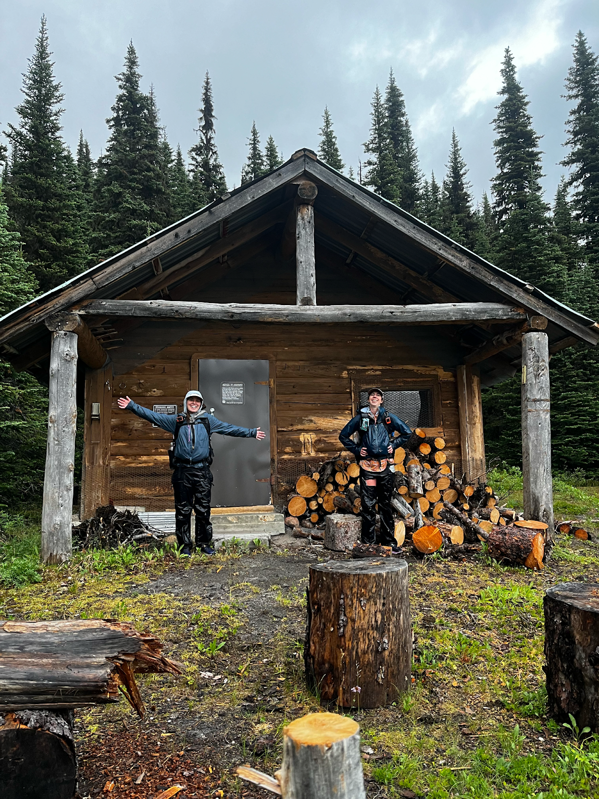
Jarvis cabin is a rustic wood cabin with everything we could want in the backcountry. A place worth another visit. We started a fire, got cozy, and dried out every wet piece of gear. We cooked our first and only hot meal, as we would cold soak the rest of the route. We anticipated warm temperatures, one of our biggest concerns on the GDR was getting too close to a wildfire—our first of many misconceptions.
Day 1: Jarvis Lake to Narraway River
Distance: 25 km
Elevation Gain/Loss: +635 m / –821 m
Total Time: ~10 hours
All night, the rain kept falling. While much of BC and Alberta suffered from extreme heat waves resulting in wildfires, we found ourselves stuck in a cold, rainy vortex. The rain made for a slow start. Knowing only grey skies and saturated bushes awaited us, the cabin was too cozy to leave in a hurry. However, our procrastination paid off, the rain finally slowed and at 9 a.m. we started hiking. The trail was overgrown leaving the cabin, making the fork back to GDR hard to spot.
The rumination of the day was the Narraway River, a crossing known as a major obstacle on the GDR. It had prevented previous hikers from completing the route and waited for us at the end of the day.
Meghan: Something inside me was telling me the river was going to be a challenge. But I pushed those thoughts aside as we still had a full day of walking before we would arrive at the Narraway.
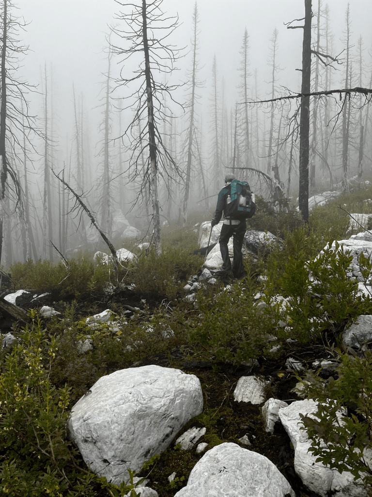
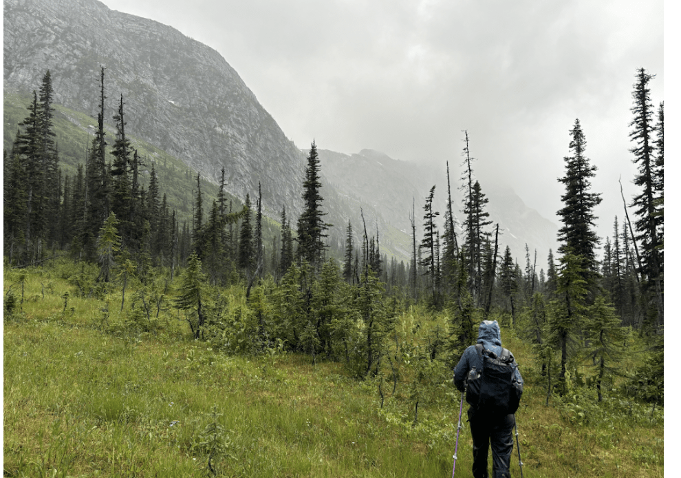
The clouds stayed low giving an ominous feeling as we navigated through an old burn area. The rain continued on and off, and between the wet vegetation and weather, we had no chance of being dry. Yet, we remained in high spirits, our energy levels were at a surplus with excitement of what was to come.
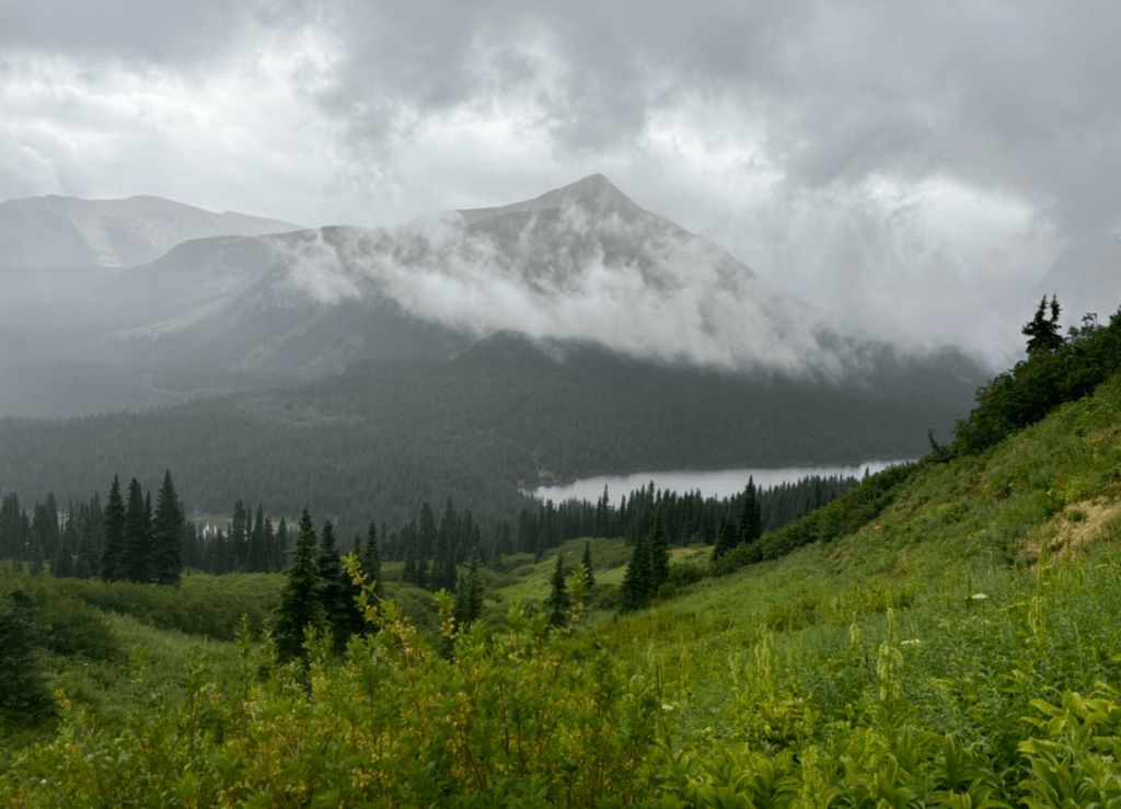
We followed a “good” game trail that faded in and out through the vegetation, leading us up to Moonias Pass. The fog limited our visibility as we hiked towards Moonias Lake. We have seen pictures of this area, and on a clear day, it is stunning. The peaks were hidden from us, but we were still treated to moody views, beautiful in their own way. After we passed Moonias Lake, the vegetation became thicker, however, we found the bushes “friendly” to navigate through.
The clouds were still holding onto the mountain peaks as we made our way toward Fay Lake. Maybe one day we will return to experience this area in all its glory, but for now, we have seen just enough to make us yearn for more. Up until this point, the bushwhacking hadn’t been difficult, and everything was going as planned. We gradually descended from Fay Lake to the Narraway, making good time. At first, navigating to the Narraway was quite enjoyable as we “meadow hopped”, navigating from one open meadow to the next, avoiding dense vegetation and trees whenever possible. It hadn’t rained in a couple hours and we were starting to dry out. However, we were about to learn that on the GDR (for us), good moments were often short and fleeting. Only a few kilometers from the Narraway river, our pace began to slow significantly. The forest thickened and we found ourselves fighting our way through.
At around 6 p.m., we emerged from the forest abruptly at the bank of Narraway, no words were spoken, and both our hearts sank as we watched our worst fear rush by us. The Narraway River was high, fast, and murky. We went to the “Best Ford” pin on our map, which previous GDR hikers found to be a good spot to cross the river. We stepped into the river and probed with our hiking poles to check the depth, and found near the middle that we couldn’t touch the bottom. The river felt extremely powerful, the kind of power that will sweep you away with little time to react. We headed ~ 300m downstream, probing potential crossings with no success, it felt too fast. So we went back and walked ~400m upstream from ”Best Ford”, where the river widened, the current slowed and became deeper. We could not touch the bottom from the side of the river bank. This was where Dan and Ben swam across, once out of the question now seemed to be a real option. It was a disheartening thought at the end of the day when we were tired, hungry, and finally dry. This obstacle was more energy-consuming. Not ready to strip down and swim across, we decided to head downstream once again and continue further. We walked downstream ~700m from “Best Ford”, where we found a crossing we could ford by linking two gravel bars. The current to the first gravel bar was fast enough to sweep you away if you lost balance, but it was worth an attempt. We crossed the river on a diagonal upstream to connect to the next gravel bar on the other side and with luck, the river never became more than knee deep for us (our height ranges from 5’2 to 5’7). It was a huge relief to get to the other side, we celebrated with dinner on the river. It was about 7 p.m., it took us almost an hour of scouting to find this crossing (noted in our tracks). That being said, rivers are always changing, year to year, month to month, and sometimes even more frequently with significant precipitation. So we don’t advise this to always be a promising spot to cross the Narraway.
As we ate our dinner, we studied the topo map and looked at the thick forest that resides on the northern side of the Narraway. We decided to get back to the GPX track, hang our food, and call it a night. It just didn’t seem smart to head into a bushwhack late into the evening without knowing if any potential campsites were ahead. We were grateful to be warm and dry.
Day 3: Narraway River to Mt. Paksumo area
Distance: 24.7 km
Elevation Gain/Loss: +1233 m / -759 m
Total Time: ~13 hours
We woke up to the sound of the Narraway River bouncing off the banks. It had rained briefly overnight, but the tent was dry. We were motivated to start hiking early as the skies showed signs of a sunny day and we were looking forward to clear views. We both felt our bodies starting to tire, but we’re accustomed to this feeling and we were eager to push for a long day. We headed into the dense forest that halted us the night before and surprisingly found open narrow corridors and rocky outcrops for the first few kilometers. The forest became denser as we moved further from the Narraway.
We moved slowly, with patience, and after a few hours, we finally emerged from the treeline into the alpine. Our spirits lifted as we traversed through wet and dry meadows surrounded by gorgeous mountain peaks. These moments of pure beauty remind us why we are out there, it was more than just to suffer.
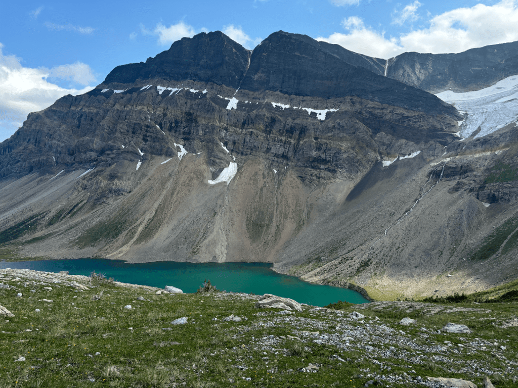
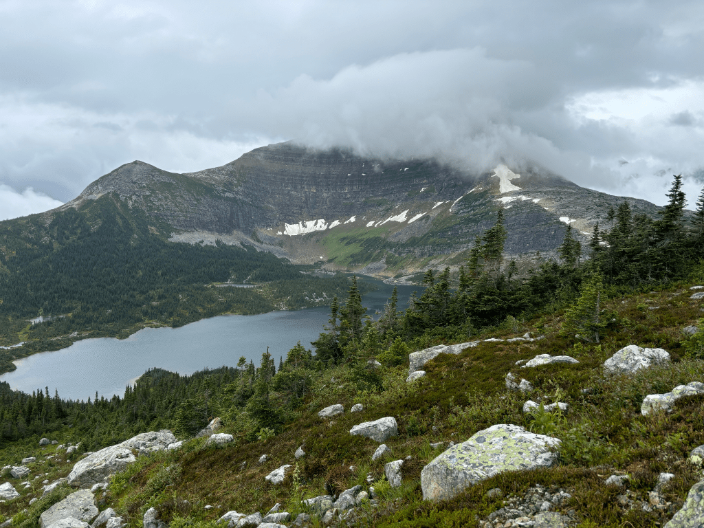
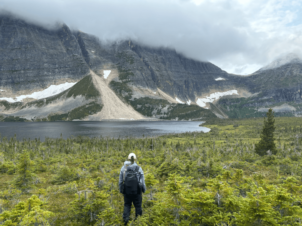
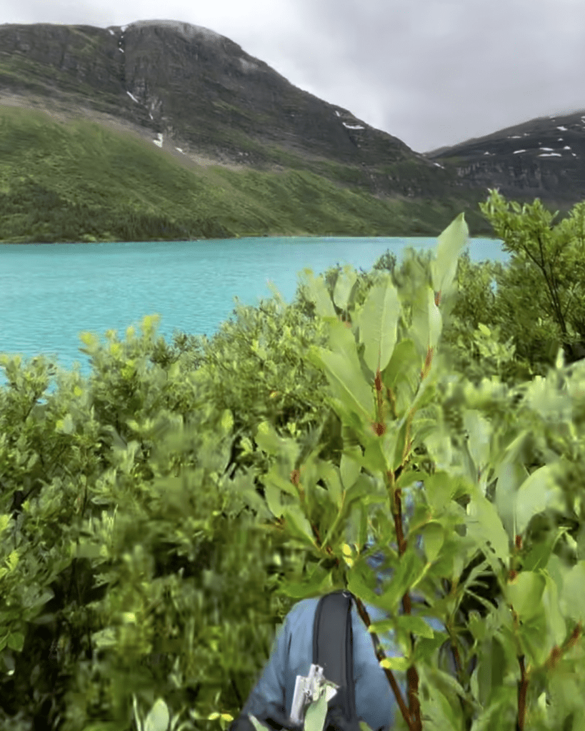
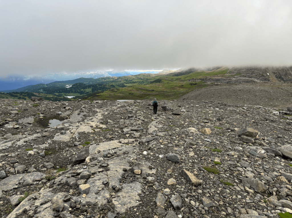
We headed down into the next valley towards Amisk Lake, and soon after we were navigating through trees and other vegetation. We found ourselves on the wrong side of the river, although we didn’t know it at the time. We remember seeing an opportunity to cross, but it was hard to tell if it was the right decision. After a few hundred meters of fighting the vegetation, we realized our mistake in not crossing the river, but now we were too far away. Our chosen route became claustrophobic, so when an opportunity to climb a big boulder and escape briefly presented itself, we took it. From here we can see what is ahead and plan how we will navigate through. We highly recommend not missing your chance to walk the North side of the river, don’t be like us. Eventually, we emerged to Amisk Lake, which is a green-blue colour, surrounded by mountain peaks, and fed by a glacier. We got a break from bushwhacking and enjoyed the wide open space. A great place to stop for a snack and take in the views before heading into the next unknown.
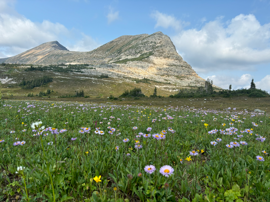
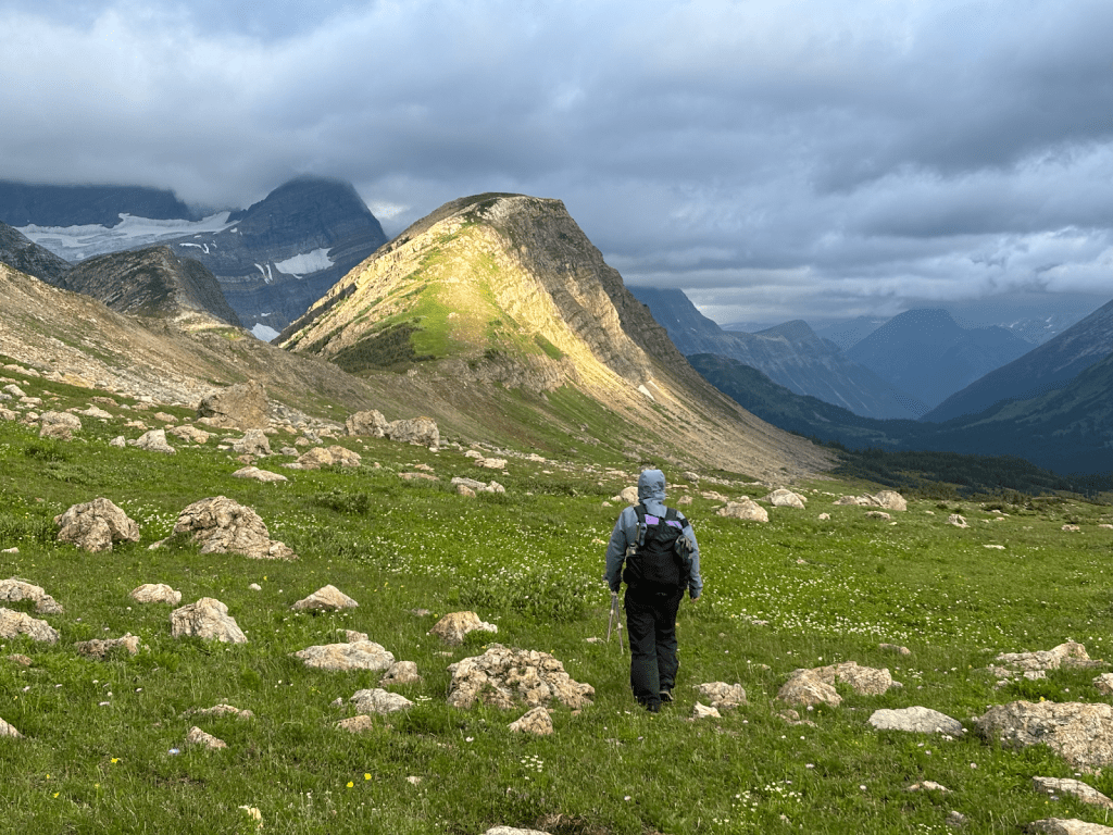
From Amisk Lake we started climbing up to Natanik Pass, an enjoyable climb yet, we could feel our gas tanks running low. As we gained Natanik pass, the wind picked up. We were dry and warm so it wasn’t anything that affected us, if anything it benefited us, as a herd of caribou stood grazing in the meadow below. They did not notice us and for some time we stood from a distance watching them graze. Eventually, they picked up our hiker scent, spotted us, and took off running. We continued hiking and enjoying the open alpine walking. This had been the best day yet! The views and alpine walking continued for the evening, and we cruised along in our element. We could see the valley ahead and after crossing Herrick Pass, we unintentionally headed north towards the Crowberry alt. We checked our map and we noticed we were off the intended GPX track we wanted to follow. We assessed the mountain ahead and instead of backtracking, we decided we could ascend to the ridge and connect on the other side in the morning.
The wind had settled and it was a gorgeous summer evening. We climbed and found a plateau made for a two-person tent with grand views. We set up camp, hung our food, and took some time to enjoy the views before calling it a night. Overall, this was a memorable day traversing the wild northern rocky mountains. The only downside of the day was not crossing the river to the north side before Amisk Lake.
Day 4: Mt. Paksumo Area to Warner Lake
Distance: 21km
Elevation Gain/Loss: +466 m / -1028 m
Total Time: ~11 hours
We woke up early, aware of our tired bodies, but we were mentally fueled by the previous day’s views. After a small push, we were back on the intended GPX track and made our way to the unnamed pass close to Mt. Paksumo. Just before we gained the pass, we turned around to snap a few photos of the views. To our surprise, an adolescent caribou was trailing us. We stopped, and the caribou stopped, it appeared to be lost or confused. The caribou decided after a few seconds, we were not who it wanted to follow and we parted ways.
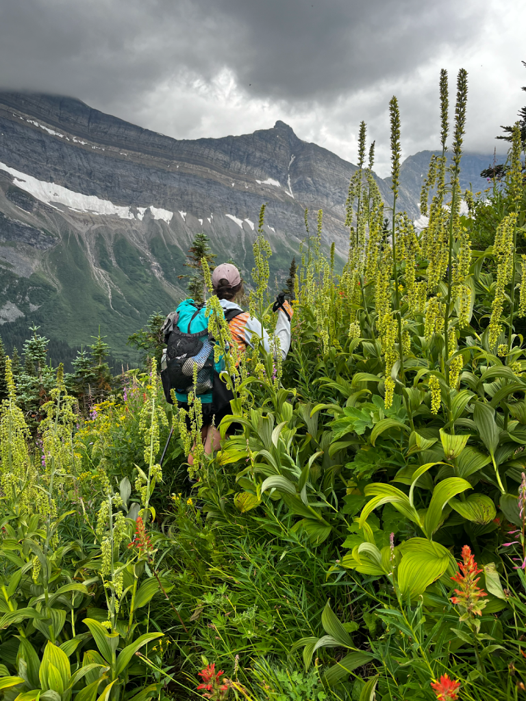
The other side of the pass offered breathtaking views of the valley we were about to stumble into, or so we thought. We headed towards the valley veering to the right. For the next couple of kilometers, we side-sloped the mountain. This was slow-moving due to the tall false hellebore and the steepness of the mountain. This is where we learned that hellebore is quite slippery to walk on, but also quite strong at the stem for pulling yourself up steep steps. We dipped up and down contour lines trying to find the easiest path. Lucky for us we were able to follow the path of a grizzly, who was recently digging and marching through the plants.
In the next valley, we branched off from Dan and Ben’s route (which we were referring to as the “Dens” at this point, the result of mixing up the names exhausted too many times) and took Walkin Jim’s route. We headed up and over another unnamed pass toward Warner Lake.
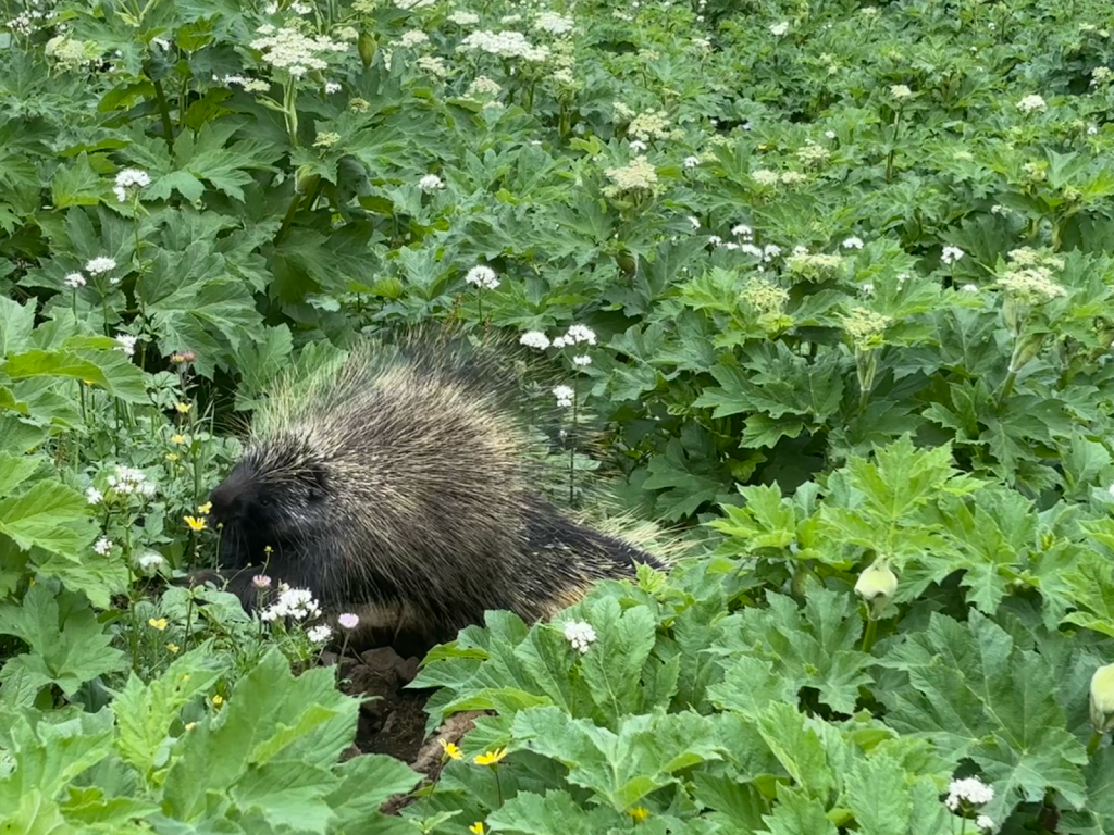
As we descended from the side of the mountain, we spotted a porcupine feeding on plants. The porcupine continued feeding, while we watched him in pure excitement. He showed no interest in us, but he ended up being the highlight of our day. An hour or so later, we descended into a valley and found a beautiful stream to take a well-earned break. It felt good to intentionally sit. As we were making our wraps the clouds began to assemble in a threatening way and then the sky began to sprinkle. We quickly got moving and headed up to the pass; it was a mellow approach and easy to navigate.
We descended into a thick rhododendron forest towards Warner Lake. The rhododendron consumed us, but at some point, there was a break in the shrubs and we crossed a stream. We enjoyed the open space of the stream before emerging back into the vegetation, where it seemed to become even thicker. We weren’t far from Warner Lake, yet the kilometers were gained slowly.
Bailee: We are only a few hundred meters from the Warner Lake campsite and I feel a shin splint start in my right leg. If you have ever had a shin splint you are probably aware of the severity that can quickly arise. This was not the place for it. By the time we reach Warner Lake, I am hobbling, trying not to put my full weight on my leg.
It was 5 p.m., so we stopped and weighed our options, and after some time we decided to camp and let the shin rest. Luckily we happened to be camped at the best bailout route of the GDR. As the day fades away we plan to attempt to hike the next day and if we have to turn around mid-day we will, if we have to ration our food for an extra day, we will. Worst case we would end the hike and leave via the ATV road.
Bailee: I hobble out of the tent to go to the bathroom before bed and find out I have my period. Tomorrow is going to suck.
Night arrives and already cozy in our sleeping bags we drift off to the sounds of the lake washing against the shore and the rain beginning to splatter the tent.
Day 5: Warner Lake to Bushwhack/Soggy Camp
Distance: 21km
Elevation Gain/Loss: +1166 m / -1142 m
Total Time: ~14 hours
The rain pummelled the tent all night, it showed no signs of letting up as we packed up. We were prepared for a slow hiking day, the objective was to get through the day. We had been warned that from Warner Lake to Limestone Lakes was some freakishly hellish bushwhacking. A daunting thought, after yesterday’s bushwhack.
We headed back into the thick rhododendrons. We took Walkin’ Jim’s ascent here and it was straightforward, following the drainage to the top of the pass. We tried our best to stay out of thick vegetation, especially the Devil’s Club that towered over us. We avoided getting too close to the drainage due to the thicker vegetation. We found the best way up the mountain was weaving between the alders and conifers (less thick ground vegetation to tangle your feet or spike your hands). The wet vegetation made for slow, slippery travel. The temperature had significantly dropped since the day before, with the rain falling hard and the wind blowing its cold Canadian Rockies breeze, we were aware our situation could change quickly. In early August 2020, in section F of the GDT after being drenched by the vegetation, we experienced how it feels when you are soaking wet and the temperature drops as you ascend and snow begins to fall. This was exactly what it felt like was about to happen again.
Thankfully, the snow never fell and we eventually made our way to Gusty Lake. Gusty Lake seemed to live up to its name. We gained the ridge and descended into the next valley. The ridge is open and nice for walking.
Bailee: I am heavily aware of the pain in my leg, fearful at any moment it may get worse. But so far the slow walking is keeping it manageable.
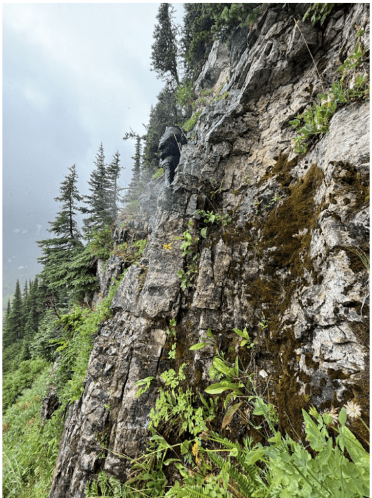
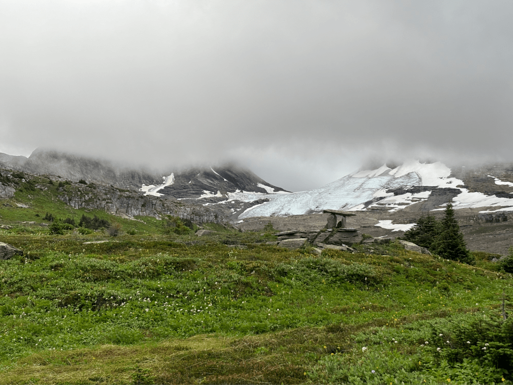
As we made our way towards Tuck Lake, we took an approach that hadn’t been done before. We were fatigued and at some point, we found ourselves with a cliff band above us. We didn’t take much time to look around. We attempted one spot but couldn’t find a way up. We saw another potential spot and it looked really good from where we were standing. We started to climb our way up, we put the hiking poles on the final ledge above us and muscled our way up. We do not recommend this scramble route, we didn’t look for better options, and we also forgot to drop a pin. We continued to pick our way up and over another shoulder and headed towards Tuck Lake, where the bushwhacking was said to only get worse. We slowly navigated our way through an old avalanche path. It could have been the weather or it is simply reality but since leaving Warner Lake the vegetation seemed to grow thicker with every step, with less and less reprieve in between. We never went to the shore of Tuck Lake, but as we climbed up and over Wapiti Pass we were hoping for some sun as we were drenched and cold. We imagined some spectacular views, but the clouds concealed any rewards from us. As we continued to push we both were becoming maxed out. Limestone lakes seemed so far away. With the Framstead that lay somewhere buried in the valley, it was just us encompassed by the forest. The Framstead is considered the other major river crossing of the GDR.
Meghan: I am tired and I can barely see the forest floor, the bush is thick and suddenly my next step does not find the ground. I took a bad fall here as I overlooked a deep hole buried by the overgrown forest floor. My left leg falls hip deep and my upper body dangles over the rooty ledge. Everything happened so fast, I was unsure if I was hurt or not. I lay motionless for a few moments unsure of how to wiggle out. I hear Bailee’s voice ask if I am ok, and then I feel a tug as she helps to pull me out.
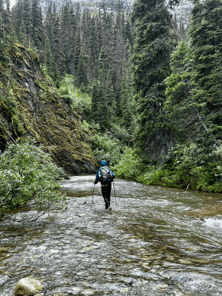
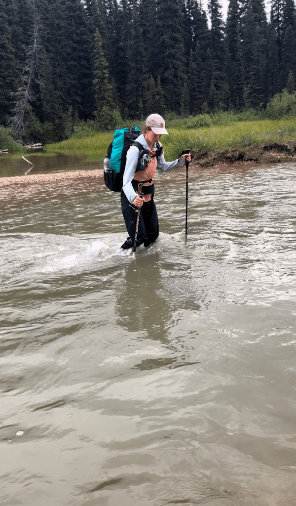
Thankfully, no emergency injuries and we keep moving. The bushwhack continued for another 4.5 hours until we hit the Framstead. We arrived at the Framstead River downstream from the GPX track crossing. We were at the point where walking in a bone-throbbing cold river seemed like a more pleasant experience than continuing to walk through the rhododendron forest. It felt good to be in an open space, it had been hours since we could stretch our arms at full length without touching anything. We had emerged from the forest and now had to walk several kilometers upstream to reach the point where we would leave the river and continue north. The Framstead had a strong flow, but only knee-deep at the worst of times. As we headed upstream we would briefly enter the edge of the forest to avoid deep, rushing pools. We stopped for dinner, cold-soaked PB&ramen, which was once a desirable meal, had merely become nothing more than a source of energy we inhaled. Cold food for cold hikers.
As we continued upstream, the river started to flow from a canyon, so we were forced to head back into the forest. Wet, cold, and exhausted we linked back up with the intended GPX track. We fought through the dense forest and thick vegetation as daylight escaped us. With every ounce of energy left, we pushed through the rhododendrons, we had to find somewhere to camp fast because our headlamps would be no use in such a dense forest. We hit a spot marked “good” on our maps. It wasn’t good at all, maybe our GPS was off, or maybe in dryer conditions, it could be considered good. But we found ourselves standing in a spot where an animal had bedded, the grasses recently flattened and water slightly pooling. We were really cold and to the point where we had no choice, but to call it camp for the night. It was dark by the time we hung our food, and crawled into bed. The rain continued to fall as we lay on the slanted and soggy ground in our damp sleeping bags. We managed to get a few laughs out about how hard the day had been, maybe it was time to reconsider our hobbies. We had thought Day 3 was slow moving, but after spending a good portion of the day battling through the thick vegetation, we set a new low for pace. This would be our worst day of bushwhacking to date. We drifted to sleep dreaming of better weather and less bushwhacking tomorrow.
Day 6: Soggy Forrest Camp to Soggy Meadow Camp
Distance: 27km
Elevation Gain/Loss: +847 m / -644 m
Total Time: ~13 hours
We don’t want to say it is impossible, but it seemed highly impossible, to die of dehydration at any point on this route. The rain relentlessly fell all night, at some point the tent reached its limit, and water began to drip inside. At this point, all of our gear had maxed out, nothing could repeal or resist water anymore, and we were perpetually wet. Food was being rationed and the desire to finish the route was far stronger than anything else. We packed up, pulled on wet clothes, and got moving without hesitation.
According to our notes from previous hikers, better hiking was only a few hundred meters away. Lucky for us, it wasn’t long before we were hiking into a meadow, and began meadow hopping. Our spirits lifted, we were back in open terrain. Walking without being grabbed by the vegetation, and seeing more than a few meters in front of us. It is like taking a deep breath after holding your breath for too long. We continued navigating, not always taking the most direct route, we wanted to stay in the meadows for as long as possible and avoid dense forests and thick vegetation. For the most part, we remember the route we chose to be quite pleasant, with only short spurts of bushwhacking. We anticipated the bushwhacking to become unbearable at some point because that was in our notes. For some reason, neither of us remembers it being that bad.
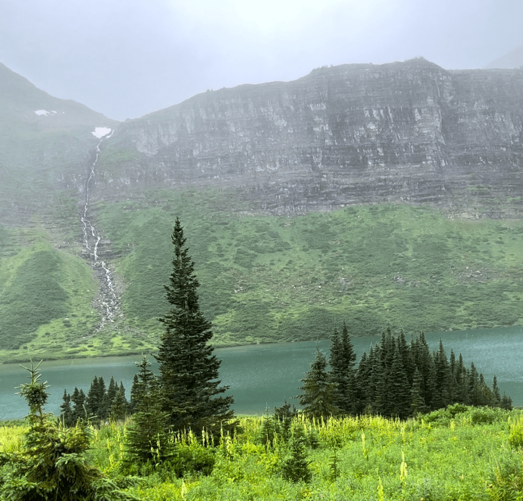
As we approached Limestone Lakes, we got a glimpse of the first lake hiding under the low-lying clouds. We could also see the dense forest that surrounded the lake, and we were headed straight towards it. The vegetation especially the willows (flashback to the Jackpine Valley in Section G of GDT) became incredibly thick. Scream all your frustration into the sky, THICK! Which admittedly, we did. The bushes spat us out somewhere around the middle of the first lake. It was stunning, even in its ominous mood. The lush green mountainside was the backdrop to this stunning alpine blue lake, with waterfalls that cascaded from the mountain to the lake. It stopped us in our tracks. As we stood in the lake, saturated and cold, we took it all in. We had finally arrived at Limestone Lakes, a place that seemed so far away merely 30 hours ago. The view left us in awe, it reminded us of what a privilege it was to be navigating through this untouched wilderness. We were filled with content. We walked the shoreline for portions of the first lake, weaving into the water at times when the vegetation became too thick and back when it seemed walkable. The bushwhack between the first and second lake was slow moving, but the trek was short-lived.
At the second lake, we side-sloped above the shoreline of the lake. The tall hellebore made for slippery travel in the pouring rain. We had exhausted our bodies, and the cold, wet, bushwhacking was not helping. We felt desperate to hike without falling and fighting forward. We held onto the thought that we were nearing the end of the bushwhacking. The last of the Limestone Lakes was supposedly the final stretch. We took a much needed break under some trees and exhaled our frustrations and emotions loudly. Dripping wet and cold, it was midday, we knew we had to keep going. After we gave ourselves some sort of pep talk, which was probably something like “We are over this route, but the only way out is to keep moving”, we continued. As we slipped and stomped forward we soon broke out in laughter, asking ourselves “Why is this our type of vacation?”
At some point, we emerged from the bush at the third lake. Here we made a mistake. The GPX track shows the route navigating around the left side of the lake, however, visually the right side of the lake appeared to be shorter. Exhausted (have we mentioned that enough yet?) and without analyzing the topo enough, we went for it. We should have known it would be trouble as we became slightly cliffed out in the beginning and had to wade through logs in knee to thigh high water for around 20 meters. After we managed this obstacle, we kept hiking the shoreline until we hit a huge cliff band. We attempted to go up and around, but it was just too steep. Finally, we came to terms we had to climb down and go back. This detour didn’t waste too much time, but enough that we were annoyed with ourselves for the mistake. It was still raining and the wind picked up once we got to the left side of the lake. However, the views captivated us and the hiking was easy. We were walking on soft, grassy, open terrain as the lake was quite low and the shoreline wide. From this point on our hiking pace began to improve significantly. The vegetation became less dense, at least in our opinion. This was the kind of hiking we love to do, a route that allows you to move freely. We hiked another 8 or so kilometers that night. Cruising at a slow and steady speed through the alpine, hiking later into the night. Bailee frequently complained about her chafe and shin and Meghan pushed through the lingering pain in her knee from her fall. We felt the temperature cooling and after swimming through the bushes and rain all day, we chose to call it a night, on another soggy campsite. We climbed into the tent around 7:30 p.m. Stripping off our wet clothes once again, and assessing our battle wounds from bushwhacking. Our cuts were red, oozy, and irritated from our skin being dirty and saturated for days. We put on our sleep clothes and added our wet puffy jackets into our wet sleeping bags, in hopes they’d dry out enough for the next day. We had roughly 45 kilometers to go tomorrow to get to the car, we HAD to get to the car. Our sleeping bags no longer dry, along with everything else, aside from our sleep clothes. Our food bags were nearly empty. Our bodies were depleted and our minds exhausted. This had to be the last night on the GDR.
Day 7: Soggy Meadow Camp to Monkman Trailhead
Distance: 44km
Elevation Gain/Loss: +1166 m / -1142 m
Total Time: ~14 hours
We woke up before daylight, as an early start was a must to ensure we finished the route at a reasonable time. The rain was still falling. Thankfully, we were both warm during the night. Somehow, we both felt well rested or maybe it was the adrenaline pumping knowing we’d be out of the wilderness that day. There was no discussion of another option.
It was a chilly morning, but our down jackets were relatively dry from their cozy sleep. We started with our headlamps, unaware of what the 19 kilometers before Monkman Trail would have in store for us. Immediately we began to climb, it would be the last real pass of the route.
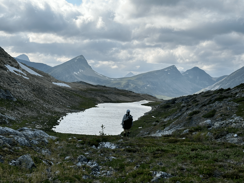
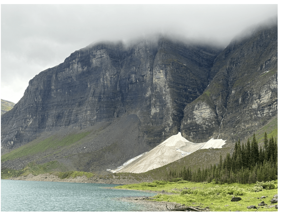
We picked our way down the rocky terrain, with the receding glacier on our left. There isn’t a wrong way down here. We gained a view of Hugh Lake and easily navigated through the tarns. There seem to be endless adventures that can lead from here. We made our way through the lush valley and eventually ascended a small ridge, then, cairns!
Monkman Lake was in view and we were around 30 kilometers from the car, we celebrated briefly and then kept moving. The cairns became more frequent and then, a pink ribbon, and then another! Neither of us had ever been this excited at the sight of a ribbon. Soon, a faint trail appeared and became more and more visible as we navigated the ridge. From the ridge, we dropped down into the forest and headed towards the lake. The trail was slightly overgrown, with alders occasionally folding across the path or vegetation hiding the way. However, the trail was always there and was easy to orient back to when we would veer off.
After what felt like no time, we were on an established trail at Monkman Lake campground, with only 25 kilometers to the car. We stopped and sat under a large tree to avoid rain, and ate the crumbs of our under-estimated resupply. The rain had eased up since we dropped off the ridge, now just scattered drizzling. From here to the car we were on a trail, a hiker highway. We soon emerged from the rain vortex, slowly stripping off layers until we were in our shorts and hiking shirts. It felt so good to be dry and warm and cruise a trail.
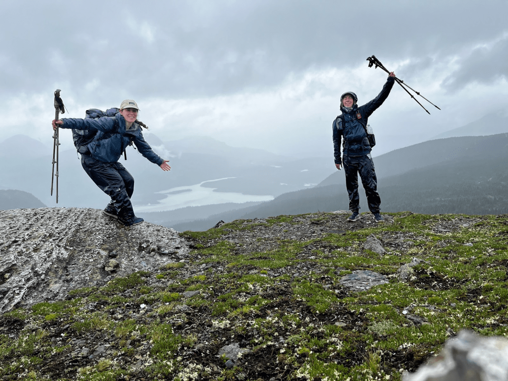
Hiking those last 25 km at a fairly quick pace, we finished strong getting to the car around 7 p.m. We sat in the gravel parking lot for a short time excited to eat snacks we had left in the car. We were eager to get out of there and head to Birgit and Kevin’s for a shower, a warm meal, and a bed. That marked the end of our journey on the GDR.
Follow more adventures at:
Bailee Fenton – Squirt: @westcoastgirl_xo on Instagram
Meghan Dasilva – Baby Hulk: @dasilva.meg on Instagram or on the web at http://www.happyhikingtrails.com/blog
Disclaimer:
Please reach out to baileefenton90@gmail.com to access the GPX tracks.
The tracks were recorded using the Gaia GPS app. While they provide a general reference, we cannot guarantee the accuracy or reliability of the data. Use them at your discretion.
References:
- Gadd B. Canadian Rockies Geology Road Tours.; 2008.
- High Route Extension of CDT/GDT. IntoCascadia. Published January 9, 2023. https://intocascadia.com/2023/01/09/high-route-extension-of-cdt-gdt/
- Hiking the Great Divide Route. Google.com. Published 2024. https://sites.google.com/view/hikingthegreatdivideroute/home?authuser=
